Over on the Facebook page for this blog I’ve been posting
a series of pictures this week I’ve simply sourced as “Library of Congress”,
but the source goes much deeper than that.The pictures are wonderful depictions of world scenes beginning in the
1890s through the 1930s. I’ve featured some here.
The collection was put together by Frank and Frances
Carpenter, a father-daughter team, during their world travels. The photos were
used to illustrate his writings regarding travel and his world geography
textbooks.
I love to snap pictures myself. Over the last five years
I’ve taken approximately ten thousand photos, myself, but over his lifetime no
telling how many photographs Frank Carter produced. The Library of Congress
collection contains 5,400 photos in albums, 10,400 loose photos, and 7,000
glass and film negatives.
Frank Carpenter was a journalist whose assignments took
him many interesting places.Being a
writing myself, I love the fact that he took his interest in travel and
photography and more or less created a job for himself.
He took a trip around the world from 1888 to 1889. During
that time he wrote a letter per week that was published in twelve different
periodicals which led to more letter-writing travels.
Where can I get a job like that?
Not only were Frank Carpenter’s geography books used in
schools for over 45 years, his writings helped to popularize cultural
anthropology and geography.
Carpenter died a millionaire, but not necessarily from
his writing and photography. He used his money to invest heavily in real estate
in the Washington D.C. area, and at one point was then able to fund his world
travels and photography “habit” on his own terms.
Frank Carpenter died in China during his third trip
around the world.
Use the “like” button above in order to join the history conversation
on Facebook and view more of Carpenter’s fantastic images.
One of the maps available from The Atlas of True Names
Take a look at the map I posted above.Notice something strange?This map is from The Atlas of True Names.
This site…..The Atlas of True
Names…..is a truly unique resource.
The website states its purpose is to reveal
the etymological roots, or original meanings, of the familiar terms on today’s
maps of the World, Europe, the British Isles and the United States……The ‘True
Names’ of 3000 cities, countries, rivers, oceans and mountain ranges are displayed
on these four fascinating maps, each of which includes a comprehensive index of
derivations.
You can read more about the site from The
New York Times or from Spiegel
Online. Apparently these maps have
been around since 2008, but I’m just now seeing them. Yes, I know that’s hard to believe, but
somehow I overlooked them.
My secret doesn’t exactly fit the image many have of me….the quiet unassuming married school marm who in the past has lugged home not just one but two large bags each night filled to capacity with papers to grade, materials to review and to plan lessons with, paperwork to complete, and an assortment of other effects that teachers just seem to accumulate.
Teachers just have that image...always doing the right thing, always saying the right thing, always being where they are expected to be, but I have this desire…
If I could….if the timing was right…..if I had the funds….if my health was better…..if I didn’t have so many obligations…if ….if….if….if….if…
IF
I
actually
had
the
nerve
I would run away.
Yes, you read that right.
ElementaryHistoryTeacher would love to run away.
The reason? Well, to travel, of course. I want to see and experience the world.
I want to see the Great Pyramid, the Great Wall of China, and see “the running of the bulls” in Pamplona, Spain.
I want to climb the Rockies, ride through the Alps, and see Mount Kilimanjaro.
I want to take a mud bath in China, take a cooking class in Thailand, and go on a safari in Tanzania, Africa.
I want to sleep in a Bedouin tent, belly dance in Istanbul, and explore the Greek and Roman ruins.
I want to watch the sunrise over the Grand Canyon, trace the route of Lewis and Clark, and actually lay on the stones where the Mayans performed their rituals.
I want to read a book in some quaint bookstore in England, I want to sip coffee sitting in a sidewalk café in Paris, and I want to lay in the sun topless like all the office girls do during their lunch hour in Malaga, Spain.
I want to ride the Orient Express across Europe, ride a lodge boat down the Amazon River and experience Victoria Falls via the Devil's Pool .
I want to see where Martin Luther nailed the 95 Theses on the door in Wittenberg, stand in St. Peter’s Square, and most importantly walk the path of Jesus through the Holy Land.
I want to skinny dip along the beaches of the Cook Islands….in particular one of the most beautiful places there…. Aitutaki Island.
Watch the video and you will see what I mean….
How did you like the music? Did you recognize it? It’s the theme to one of my most favorite travel shows.
You see, as much as I would like to visit all of the places mentioned above and do the things I listed the likelihood of any of them coming true at this point is next to nothing. I’m not looking for sympathy here….just being realistic. I might get to some of those things, but the reality of just running away and experiencing the world is unrealistic for me at this point for many reasons.
Therefore, I have to satisfy my desire vicariously.
I’m not usually a big fan of most travel shows, but Globe Trekker on PBS is one way that I can cure my wanderlust. The guides on the show travel the way I would like to. They explore the authentic culture of every region they visit yet they still hit on the important historical sites as well. Ian Wright, one my most favorite guides on the show states he enjoys “living cheap and getting dirty” on his travels, and I have to say a little of that would be interesting. Justine Shapiro, another host on the show, states, “The way to connect with other distinct cultures is to go with an open heart and spend time with the locals.” That would be part of my schtick if I was able to just …..GO.
In fact….the guides on the show are one of the reasons why I like it so much. There are several of them and they rotate through the episodes. They all have interesting backgrounds and bring their own little spin to the show. For example, Megan McCormick is a former English teacher in Japan. Zay Harding grew up in Hawaii and became interested in world cultures through the Boy Scouts, and Holly Morris is a print and media journalist with Adventure Divas.
From time to time I’ve used clips found at YouTube or the show’s main site in the classroom. These do need to be previewed for inappropriate content, but so many of the clips have value when teaching geography, world cultures or history. Most of the episodes can be searched by location. Often I’ve used them for independent study and allowed students to just pick something and run with it the way their heart takes them.
Sometimes THAT is when the best learning takes place.
The main website for Globe Trekker can be found here . Enjoy!
This image has appeared in Absolut vodka ads south of the border. This article from the LA Times states:
The billboard and press campaign, created by advertising agency Teran\TBWA and now running in Mexico, is a colorful map depicting what the Americas might look like in an "Absolut" -- i.e., perfect -- world.
The U.S.-Mexico border lies where it was before the Mexican-American war of 1848 when California, as we now know it, was Mexican territory and known as Alta California.
Following the war, the Treaty of Guadalupe Hidalgo saw the Mexican territories of Alta California and Santa Fé de Nuevo México ceded to the United States to become modern-day California, Texas, New Mexico, Utah, Colorado and Arizona. (Texas actually split from Mexico several years earlier to form a breakaway republic, and was voluntarily annexed by the United States in 1846.)
The campaign taps into the national pride of Mexicans, according to Favio Ucedo, creative director of leading Latino advertising agency Grupo Gallegos in the U.S., which was not involved in the Absolut campaign.
Ucedo, who is from Argentina, said: “Mexicans talk about how the Americans stole their land, so this is their way of reclaiming it. It’s very relevant and the Mexicans will love the idea.”
But he said that were the campaign to run in the United States, it might fall flat. Hmmmmmm…really? I wonder why?
Ucedo’s reasons why the campaign would fall flat, however, twists my bloomers a bit…..He says, “Many people aren’t going to understand it here. Americans in the East and the North or in the center of the county -- I don’t know if they know much about the history. “Probably Americans in Texas and California understand perfectly and I don’t know how they’d take it.” While I agree that many Americans don’t know ALL of the details regarding their history…which I find sad, one thing most adults do know is the basic shape of our country on a map.
Absolut had to know this is more than just a cute little ad.
The ad's message has more than one intention, and I don’t really care if Absolut has apologized or not. The small caption published along with the map says that the ad was created for the Mexican audience only and was intended to recall “a time which the population of Mexico might feel was more ideal.” What’s next? Will we soon be seeing ads intended for German citizens showing maps with concentration camps highlighted? Will Italians see ads showing the gradeur that was Rome by depicting Christians being torn apart by lions? What about an ad targeting Native Americans depicting North America in its natural state? In this type of context we can see how these types of things can be offensive to some.
While I agree that the examples I set out above are extreme compared to a mere image showing a map of past boundaries even a map that seems innocent enough can portray mixed messages in society. For example, think of the mixed messages if the Absolut company decided to run an ad campaign depicting a map showing the United States as it appeared in 1866 or 1867…..What types of reactions would that map garner?
Perhaps it's been awhile since you studied geography. Here are 13 milestones in the field:
1. 2900 B.C.-The Great Pyramid of Giza in Egypt is built. Perfectly square at the base and is aligned perfectly on North, South, East, and West lines.
2. 2300 B.C.-A map of the city of Lagash in Mesopotamia is carved in stone in the lap of a statue of a god…..it is the oldest known “city map”
3. 530 B.C.-The Pythagoreans teach the Earth is a sphere and not in the shape of a disk.
4. 240 B.C.-Eratosthenes calculates the circumference of the earth with near accuracy
5. 190-120 B.C.-Hipparchus, a Greek astronomer, is the first to use latitude and longitude.
6. 271 A.D.-Magnetic compass is used in China
7. 1000 A.D.-Vikings colonize Greenland and “discover” America, establish a colony in Newfoundland. Their stay is brief and has no lasting impact. The word discover has quotes around it because there are several theories concerning others who were first to discover, and let's not forget that the Native Americans who lived there already knew about it. :)
8. 1275 A.D.-Marco Polo arrives in China, enters the service of Kublai Kahn. Polo’s book appears in 1299.
9. 1375 A.D.-The Catalan Atlas is completed by Abraham Cresques and was commissioned by the King of France. It contained stories concerning the riches of Mali that told tales that gold “grew like carrots” and was brought up “by ants in the form of nuggets” and was mined by “naked men who lived in holes.”
10. 1405 A.D.-Chinese begin voyages in Indian Ocean under Admiral Cheng Ho who was later known as the Chinese Christopher Columbus for his wide ranging voyages.
11. 1492 A.D.-Columbus lands in the New World though he believes he has reached the Asian continent.
12. 1497-98 A.D.-Vasco da Gama becomes the first European to sail to India and back.
13. 1507 A.D.-the Walseemuller map names the New World after Amerigo Vespucci, not Columbus. There are other theories regarding how the continent received the name America besides the "Amerigo" story.
The announcement this past Saturday regarding the new Seven Wonders of the World got me to thinking about how I could use the old and new list when school starts. The first couple of weeks of school are always a little different as students get used to procedures, schedules are continually tweaked, and I’m attempting to get to know the level of background and skill knowledge of students.
The following is a sketch of an idea that might be interesting to use during the first few days of school----
I’m fairly certain none of my students would be able to correctly name the Wonders on the list that has been around since the Middle Ages. Can you?
So, how'd you do? The website found here might help you identify the former Wonders of the World. I would hope that you at least got the third one---The Great Pyramid of Giza.
I’m sure many of my young ones would at least state the image is an Egyptian pyramid. As far as the other images go I would give students a little background to the old Seven Wonders list and identify each of of the images----where it is and how it figured in with history.
I would ask students to look at the images again to see if they notice anything in common with them. Notice that all of the images are produced with the exception of the Giza pyramid. There's a great reason for this. The locations that we have long called the Seven Wonders of the World are mostly gone. We have the skeletons and foundations of some, but others......basically they are myth long since eroded into a faint memory.
With this mind I would direct students to some other images. Do you know these?
They are more recognizable, aren't they? I'm thinking that just like you some of my students would know some of these. If you need some help check out the Seven Wonders of the World announcement page from this past weekend and check yourself.
I'm thinking I would identify the ones students don’t know and then divide students into seven research groups to complete a mini-project on their assigned wonder. Students would need to identify their wonder, identify where it is, and the history behind it. Students would create a large image of their wonder and color it. I would also want students to determine why they think their wonder was included in the list. Why is it significant for the world to call it a wonder? Students would present their wonder to the class and at the end of the presentations the data and drawings would become one our first hallway presentations of the year.
I've not fleshed this whole thing out yet....I need to look for great web pages I could bookmark for students to use in their research, I need to write a formalized lesson plan, and I need to relate my standards to an assessment rubric. I need to create a slide presentation for the images.
As a summary there are many directions I could go that could lead to some interesting discussions about history and how we relate to it. Why did we need a new list of "Wonders"? What types of buildings were included in the old list compared to the new list? How does religion play into both lists? Is the old list located in one general area of the world compared to the new list? Why?
The most interesting question I could pose to students is regarding how the lists were compiled and how technology figured in to the whole process.
Hmmmm.....what do YOU think? Got any great ideas regarding presenting the NEW Seven Wonders to students?
Thirteen Places Elementaryhistoryteacher Wants to Travel to
1. Great Britain 2. Italy 3. Greece 4. Europe via the Orient Express 5. the Rockies via the American Orient Express 6. Australia and New Zealand 7. China 8. Kenya 9. Alaska by cruise ship 10. the Holy Land 11. Grand Canyon 12. New England in the Fall 13. India
Links to other Thursday Thirteens! 1. (leave your link in comments, I’ll add you here!)
The purpose of the meme is to get to know everyone who participates a little bit better every Thursday. Visiting fellow Thirteeners is encouraged! If you participate, leave the link to your Thirteen in others comments. It’s easy, and fun! Be sure to update your Thirteen with links that are left for you, as well! I will link to everyone who participates and leaves a link to their 13 things. Trackbacks, pings, comment links accepted! View More Thursday Thirteen Participants
Natural vs. man-made is a hard concept for nine year olds to grasp when they live in a techno-world where real is fake and fake is real. I attempted to introduce this topic to them today.
Students were given a pristine sheet of white paper. Luckily I remembered to remind them not to make any marks including their names on the paper until they received instructions. If I hadn’t given that instruction I would have had several Picasso’s in the room before I had handed out all the paper. I asked students to fold the paper in half from top to bottom and make a crease in it. As I instructed them I modeled what I wanted them to do.
Once their paper was creased students were asked to open their paper up. I asked them to pretend that they were with someone who did not know anything about the United States. The someone didn’t know where the United States is or what it would be like to live here. I then asked students to sketch an outline drawing of a map of the United States to begin their discussion. The catch was they couldn’t look at anything. They had to draw their map from memory. Looks of terror came across some of their faces. One young man began to open his book. I stopped him. I tried to ease some minds by telling them that there are no rights or wrongs for this activity, but they did need to try.
Most everyone got the basic shape. All but a couple included the shape of Florida. In each group I taught today a few included inset maps of Hawaii and Alaska which I hadn’t even thought of. Two or three included some major cities. I called time and drew an outline map of my own from memory. After eight weeks of summer I was a little rusty, but the basic shape was there.
I then asked students to redraw their map in the bottom half of their paper now that they had a model to go by on the board. They were more determined and self-assured this time.
The next question I posed was about things students could add to their maps to make the certain someone they were with fully understand the United States. I asked students to volunteer items we could use for a classroom list on the board. Here are some of their responses:
state boundary lines cities mountains rivers Statue of Liberty Empire State Building Daytona Speedway plateaus Mount Rushmore the Constitution Atlanta Mississippi River Grand Canyon Atlanta Zoo Stone Mountain Declaration of Independence Washington D.C. New York City Alabama map scale map key title for map oceans compass rose Underground Atlanta Disneyland state capitals state birds/products/etc. Golden Gate Bridge Mall of America
I kept taking responses until almost everyone had suggested something. A few suggested London or the Leaning Tower of Pisa. I declined to add those since they are not in the United States.
I ‘m fairly pleased with the list my new students came up with to represent what the United States is all about. Of course I love the references to the Declaration of Independence and the Constitution. Prior knowledge always helps later when we study the formation of our government. The suggestion about Daytona Speedway, well, I am in the deep South, you know. That’s to be expected along with the Atlanta landmarks like Underground and Stone Mountain.
It’s clear that my third grade colleagues did their job as these students understood any bona fide map should have a title, compass rose, and map scale. I can refer to the suggestion for state boundary lines and state capitals later on next week when I discuss the difference between political maps and physical maps.
After we exhausted our suggestions I told students that I could look at the list and divide it up into two categories. I reminded them that all of the list entries were great features of the United States. I linked the word feature to the word characteristics so they would understand they can be used in place of each other. Finally, I told students that we were going to spend a few days talking about natural features of the United States. I instructed them to watch me as I deleted everything on the list that is man-made. Only the items in green made the cut…..everything else I deleted by drawing a line through it.
There were several gasps when I deleted state boundary lines so I stopped marking items out to elaborate a bit. I reminded them when they crossed the Alabama state line they don't see an actual line across the Earth. They agreed. I reminded them that political boundaries are ideas of man and are not natural to the Earth.
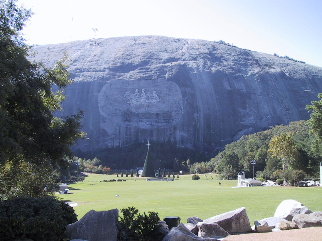
Many were surprised that Stone Mountain was left in the category of natural features. Find out more about Stone Mountain here. I reminded them that the parking lots, buildings with exhibits and stores, the train that circles the mountain of granite and the carving on the face are all man-made, but the mountain itself is natural to the Earth.
Making the list together and then observing me cross most of the list off is a very powerful image to students. It helps them have a visual for the difference between natural and man-made. I found out what my new students think America is. I also garnered some important information regarding their prior geographic knowledge. It was fun too!