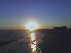
Saturday, September 07, 2013
The Artist Explorer
What do you immediately think of as you read those four words?
More than likely, you would throw out some of the more famous explorer's names and where their expeditions took place.
Some of you might tell me about their goals such as claiming land for the monarch who financed the expedition and how in the case of some bringing Christianity to the natives was in most cases a guise to seize lands and riches.
You most certainly wouldn't be wrong, but as many expeditions to the New World continued more people arrived who weren't just fortune hunters, soldiers and religious men wanting to save souls.
Sometimes the monarchs themselves would order certain people to go along, and in the case of explorers Jean Ribault an Rene Laudonnere, the French monarch ordered an artist to go along and capture not riches or natives but capture images of the things he saw in the New World.
The artist was Jacques Le Moyne de Morgues who lived between 1533 and 1588.
Le Moyne went along on Ribault's expedition in 1566 to what we would consider to be north Florida near the St. John River. Ribault hoped to establish a colony near present day Jacksonville, and he ended up building Fort Caroline.
Le Moyne not only served as an artist but was very useful as a cartographer.
The expedition erected a stone marker near the mouth of the St. John River which happened to be a standard French marker used in the New World. It was a hexagonal column of white stone engraved with the royal standard. Eventually, Le Moyne writes that the Timuca, a Native American tribe in the area, began to venerate the marker as if it was an idol.
Eventually, relations with the natives soured, some members of the expedition grew weary of the leaders and led mini revolts, and rival expeditions from other nations caused problems.
In 1565, a group of Spaniards led by Pedro Menendez de Aviles attacked the men at Fort Caroline.
Le Moyne made his escape with a few others, but only one of his drawings survived. What we do have are engravings which are recreations based on Le Moyne's memory. They are important because they happen to be the earliest images from the New World. Engravings of his work exist today as only one of his New World drawings was saved. I've posted one of the engravings at the beginning of this post. Le Moyne also penned an account of the voyage titled Brevis Narration Eorum Quae in Florida Americai Provincial Gallis Acciderunt in 1591.
Le Moyne never returned to the New World. He devoted the last years of his life creating botanical art.
You can see more engravings based on Le Moyne's drawings here.
Another great source you could explore is The New World.
Monday, August 09, 2010
Northwest Possible
Yes…yes….I know….there was an element of greed, power, and thirst for adulation but the men who kept going out time and time again weren’t just power or attention hungry. These were men who kept going out time and time again even after the growing body of evidence pointed to the fact that all that awaited them was another dead end and possibly death.
When it became evident after many years of searching that there was no water route across the United States the explorers began to head north in their search. If you travel far enough the Northwest Passage does exist. Unfortunately, the waters are frozen for most of the year and the quest to finally make it through from the Atlantic side to the Pacific claimed many a life.
Look at the painting I’ve posted below:
The painting is titled The North-West Passage by John Everett Millais and it hangs in the Tate Gallery in London. Notice the maps and other mementos of the sea that surround the old man and the younger girl. Notice the man’s clenched fist. Millais meant for this painting to elicit public sentiment and represents British frustration at their failure to conquer the passage.
Millais completed his painting in 1874. Twenty-nine years earlier Sir John Franklin had gone missing along with the crews of the HMS Erebus and Terror during a Northwest Passage expedition. In 1850, Robert McClure and the crew of the HMS Investigator were sent out to search for Franklin. McClure and his men overwintered in the Arctic three different times before they finally circumnavigated the Americas by discovering and traversing the Northwest Passage over ice and via ship. McClure and his men had to abandon their ship when it became caught in the ice during their second journey and just recently the ship was discovered in 36 feet of water in relatively good shape.
See the article here.
The find reminds me of the fictional move National Treasure and the location of the Charlotte……a ship that held important clues for Nicholas Cage and is a wonderful connection for kids to make between history in a book and history in real life.
Thursday, November 19, 2009
Who the Heck Is Thorfinn Karlsefni?

There you go. That’s it. Wow, that folder hasn’t seen the light of day in…..well, just blow the dust off it and open it up.
Those are usually the top three names I get. Most of the time folks just give me Erik and Leif.
What about Thorfinn Karlsefni?
8. Thorfinn grew up in Iceland and can count Aud the Deepminded, a queen from the British Isles and Ugarval, King of Ireland in his lineage though I have found no verifiable reference to Ugarval.
Monday, October 12, 2009
Staking My Claim...Again
I’ve been at the beach…again…for the last couple of days, so it’s more than appropriate to share a repeat of an earlier post written on this very same beach three years ago this month…..
Mr. EHT and I were up and out very early this morning enjoying yet another sunrise on MY beach.
It is not lost on me how things change….and how they remain the same.
Enjoy my post I Conquer This Beach in the Name of ElementaryHistoryTeacher!
Thursday, July 30, 2009
MY St. Augustine
The credit for founding St. Augustine goes to Pedro Menendez de Aviles in 1565. He was a Spanish admiral and pirate hunter.
Monday, September 15, 2008
Tools of the Trade: Study Guide

*Has your child been bringing home his/her textbook and reading a little each night?
*Has your child asked for your help regarding the unit vocabulary?
*Have you seen your child’s Social Studies folder?
Invariably the answers would be:
*I thought they couldn’t bring their book home, or…..textbook? What textbook?
*What vocabulary words? You mean his/her spelling words?
*What notebook? You mean his/her Trapper Keeper I picked up at Walmart?
At this point I’d bring out my copy of the state objectives for social studies and I would go over the items students were to master. As of last year our standards are now printed in our textbook so that makes it a bit easier to share with students and parents. Most parents are simply blown away by what their child must know at the fourth grade level....sometimes I am as well.
In Georgia, fourth and fifth graders complete the very same content they will see again in their high school American History course. Fourth graders journey from Native Americans prior to 1500 to 1860…just shy of the Civil War, and fifth graders continue by beginning with the Civil War and on through present day. It can be quite a daunting journey for students and their parents who are not used to the large amount of content, new vocabulary terms, and intricate details. For example, the new standards for third grade contain 10 main standards with 25 elements. The new fourth grade standards show 16 main standards with 42 very detailed elements. From third to fourth students are expected to take a skip, leap, and a very high jump in the amount of content the state of Georgia wishes to cram in little heads. You can view Georgia’s fourth grade standards here, and fifth grade standards here.
For the last several years Georgia Standards in all subject areas have been revamped and then slowly rolled out by subject matter. The 2008-2009 school year is the year Social Studies standards are being rolled out. Realistically there is nothing new for me and my fourth and fifth grade colleagues other than the stopping and starting points involving the Civil War (I have always taught the Civil War since I began teaching fourth grade). The other main difference with these “new” standards is a few things have been deleted or worded a bit different. For example, in the old standards I was to make sure students knew about the Native Americans groups in South America….Aztecs, Mayas, and Incas. Now that standard is gone, yet magically these native groups appear from the fog to become the nemesis of various Spanish conquistadors.
Getting back to my study guide I knew early on in my teaching that I had to provide something for parents to use as tool. I also needed a tool to help students get an overview regarding what we would be studying for the unit, and I found that the study guide could serve to help me as well. By providing the study guide I indicate I’m willing to help, willing to provide more information, and I’m there for parents. Once I’ve “taught” parents to look for the study guide many of the phone calls, notes in their child’s agenda book, and emails cease because the study guide has everything a student and parent needs in order to be successful with the content.
The image I’ve placed here with this post is a typical study guide for one of my units. If you click on it you will get a much larger image. I’m also reproducing the text for you below if you would like to cut and paste.
Over the years I’ve had to tweak my study guides depending upon vocabulary changes, a new textbook adoption, and even due to the lesson plan format requirements my school system metes out. This particular study guides goes along with the Learning Focused theories hawked by Max Thompson….notice I have an over-arching essential question for the entire unit and further down a set of key questions that also serve as the various lesson questions.
Essential Question: What was the Age of Exploration, and what effect did it have on the Americas?
Following the essential question are the standard elements for the particular topic. I think it is important for students and parents to know exactly what is expected. Students cannot hit a target unless they are shown where the target is. Reading through the standards I’m sure you understand that nine and ten year olds would not understand the language. This is why I generally spend the time following a unit test handing out the new study guides, and I go over it in depth with the kids. We find the verbs in each standard….describe, explain. We discuss various words in the standards such as reasons, obstacles, and accomplishments to determine if we know what they are and so on through each and every standard. Sometimes I have students write a clue word or words out to the side of each standard to job their memory. Here are the standards as they appear on my study guide:
Standards: Students should be able to:
*Describe the reasons for, obstacles to, and accomplishments of the Spanish, French, and English explorations including the explorations of Cabot, Balboa, Ponce de Leon, Columbus, Hudson, and Cartier.
*Describe examples of cooperation and conflict between Europeans and Native Americans
*Describe how the early explorers adapted, or failed to adapt to various physical environments in which they traveled.
*Explain how the physical geography of each colony helped determine economic activities practiced therein
*Describe opportunity costs and their relationship to decision making across time (such as decisions to send expeditions to the New World).
The next two sections of the study guide are fairly simple…..I provide students with a date for their unit test, and I provide the textbook pages. The page numbers help the parents out more than the students. Students cannot go home and say they forgot or more importantly cannot tell their parents I didn’t tell them. My rear end is covered because parents know I always give a study guide at the beginning of a unit…..come Hell or high water. Here are the test and textbook sections:
Final Unit Test: The unit test will be given on Wednesday, November 1st.
Textbook: This unit of study is presented in the following pages of our textbook: 84-119.
As I stated before the key questions serve as my lesson questions for the unit. This study guide indicates six questions so I have at least six lessons in the unit. This doesn’t mean my unit is six days. Lessons can last two, three, four, even a whole sometimes depending on the content. Sometimes I allow the content itself to drive the number of lessons or the lesson question. Sometimes our text does this. Notice the sixth question involving latitude and longitude. This is a skill students should know, and it happens to be a lesson included in our text so in this instance the text drove my decision to add the question/lesson. Notice how I explain a little about the key questions. Students should be able to answer these questions following a lesson. The purpose of the lessson is to find the answer to question. I begin the lesson by identifying the question, and I close the lesson by revisiting the question and we look at possible answers. Here are the key questions:
Key Questions: The following questions will help students review the information presented during the unit of study. Answers can be located in the textbook or class notes:
1. How did early European, African, and Asians trade?
2. What new technological advances led to the discovery of North and South America?
3. Who were the early explorers in North America and what did they discover?
4. What was the effect of continued exploration in North and South America?
5. What types of people lived in New Spain and what kinds of lives did they lead?
6. How can lines of latitude and longitude help us locate places on Earth?
The final section of the study guide is for vocabulary. Notice I have divided it by lesson and have seperated the words into columns. I also provide some hints regarding where definitions can be found. While many of these words are in the text I often have words that aren’t. Students have to resort to using their all important notebook which I teach is the most important tool they have for learning. When we go over the study guide I say each and every vocabulary word and then ask students to repeat them after me. This particular activity is usually fun as I try to use proper pronuciation of the Spanish and Portuguese names. We all usually resort to fits of giggles as the kids try to pronounce the names like I do. Some are really intently serious about it. Students usually ask to go over the names one more time.
Here is the vocabulary section (I only included the first column of words….you can refer to the image for the rest):
Vocabulary: You should be able to identify the following terms in multiple choice format. Students can locate the words in their textbook or class notes as we progress through the unit. Vocabulary flashcards for each word including definitions and illustrations are due on test day.
lesson 1
kingdom
Ghanacaravan
Mali
Mansa Musa
Songhai
merchant
Marco Polo
Kublai Khan
the Silk Road
Zheng He
Friday, October 26, 2007
The Door of No Return

Until the location of the image was correctly identified by Keith as the Island of Goree off the coast of Senegal the picture posed a postive impression. No one considered the image could represent something sad and tragic.
I’m going to explain the image by telling you a little story…..
The year is 1540. You are an African tribesman going about your daily business early one morning. Let’s say you are sitting outside your hut working on a basket that you will use to store food. Suddenly you are surrounded by fierce looking warriors from a neighboring kingdom your chief has been at war with. Now you are their prisoner, and as the custom dictates you are now the property or slave of the neighboring king. You travel at the point of several spears to a location far, far away from your hut, your village, and your family. No one saw you being taken, and you were unable to say goodbye.
After a couple of days of walking your captors meet up with a group of very light-skinned men. You have never seen people such as these. They smell funny and have hair all over their faces, chests, and arms. Strange sounds come from their throats that make no sense. Your original captors leave you with the light skinned men who immediately place shackels and chains around your neck, wrists, and ankles. They use long sticks to prod you along the path and occaisionally slam the sticks against your body when you don’t move fast enough.
Eventually you meet up with other light skinned men who also have prisoners. You scan the men, women, and children who are also in chains for a recognizable face, but they are just as strange as the light-skinned men, but as your eyes you realize they are just as confused and scared as you are.
At the end of the journey you know you are coming upon the coast because you can smell the sea. Suddenly you notice a very large building looming ahead. It is the largest structure you have ever seen. It’s not made of plant material like your hut…..it’s constructed of rock and rises from the ground two or three stories. The noise level is very high as prisoners like you are screaming and crying. There are wagons and carts going this way and that and many, many more light-skinned people are moving about. You are forced to enter the large stone building and eventually you are thrown into a very small room with several other prisoners. There is no window and a wall that you can see through at certain points prevents you from walking out.
Time passes very slowly. You loose track of how many days and nights you remain in the room. There is no place to relieve yourself and the food that is thrown to you and your cell-mates is often unedible. You begin to fight over it with the other prisoners even though you know you can’t it.
At one point the barrier keeping you in the cell is opened and the light-skinned men come in. They use their sticks to push and prod everyone out into the passageway. You are lined up and forced to walk. The passage is so narrow you could touch the walls on either side. Up ahead you begin to see light…the first light since entering this evil place. You continue to hobble towards it with the others. As you get closer to the light you begin to blink and your eyes water. Suddenly you find yourself through the opening and into the warmth and brightness of full Sun. You breathe in and find that there is no more smell of humanity and death.
Unfortunately, what you don’t realize is you have just walked through the door of no return and are about to be placed in the hold of a Portuguese slave ship…….
My original wordless image is from the House of Slaves on the island of Goree. The story goes that slaves would leave the many, many Portuguese trading centers along the West African coast via the doors that led directly to the slave ships. There is some question regarding the authenticity of the doorways which are usually designated today for tourists to see. In some instances scholars are not certain slaves actually walked through the designated doorways, but they had to leave the trading centers somehow and the doorways are powerful images that draw many African Americans each year as tourists.
Some historians have stated as many as 12 million Africans were transported from their homes into slavery. Of that number it is estimated only 26,000 (still a large number) actually passed through Goree’s House of Slaves which was built in 1776. There is a great Time Magazine article about the island found here.
While slavery in Africa had exisited for hundreds of years prior to European exploration we have the Portuguese to thank for the exportation of African slaves from the west coast of the continent beginning as early as 1444.

Eventually the Dutch seized all Portguese possessions in Africa in 1637, however, the slave trade from Elmina continued until 1873 when the castle became the posssession of the British Empire.
I’m still thinking about the original impression my readers had of my image. Why so positive? I’ve used this same exercise in the classroom with students and had similar results. Going through a doorway often means a transition into something better, and I’m fairly postive none of Wednesdays participants have ever entered into a slave situation, so they have no context of what it means. Of course, I have had the jokester occasionally who quipped entering the door of my classroom is often entering into servitude.
History can often be a difficult subject to teach in that students have no frame of reference for certain time periods in history. This is where building empathy comes into play. I often try to place students in the role of the historical figure I’m trying to explain whether it is a slave or slave owner.
These concepts are so foreign to students that they can’t relate to either without stories, role play, and much introspection.
Wednesday, October 17, 2007
Testing a Foundation of Knowledge

Suddenly my elementary students find themselves exposed to a bit of world history and are attempting to pronounce words such as Renaissance, place names like Constantinople and Songhai and over twenty-five various names like Alvar Nunez Cabeza de Vaca.
We have fun with the content by mapping various journeys and playing matching games with names of explorers and their accomplishments. We explore online, watch videos to gain visual images, I provide students with opportunities to uncover content independently, and I get to tell a few great stories as well. However, the bottom line that lurks behind the scene is six months from now my young students will be judged on how well they know the content and I will be judged on how well I teach based on the state test. Students must recall the hit parade of explorers, their accomplishments, and the details regarding country interaction from the 1400s through the 1600s by answering approximately 60 multiple-choice questions spanning exploration content as well as details learned about ancient Native Americans and historical events during the 1700s to the mid-1800s.
Should a nine year old student be required to recall this sort of information several months later? Is this really developmentally appropriate for the majority of students?
In my own experience I feel a large section of my students are are too immature and lack any sort of foundational knowledge to connect with the standards I teach as preparation for the type of test the state gives. At fourth grade educators and parents are still dealing with many students who have difficulty reading the textbook because the text tends to be a year or two above the actual grade level, and students lack knowledge regarding textbook construction. Many of my students are still struggling with mastering math facts and spelling patterns. Is it really realistic thinking that a great number of my students can also recall historical minutiae when taking a multiple choice test as I have described six months after the fact?
The content I teach as well as the content that is taught in the fifth grade is intended to be foundational knowledge. Any builder who really cares about the integrity of their creation would never test the building’s foundation without making sure a firm foundation existed. I love the way the state of Georgia introduces American History to students in fourth and fifth grade, and don’t want to change that. What I would like to see is a state test where students use the historical content to show they have mastered key Social Studies skills.
Examples of released questions can be seen here and here.
Rather than judging little Bobby or Sue by giving them a description of a an explorer and his accomplishments and asking him/her to choose the correct name from a field of four choices I feel it would be much more reasonable and appropriate at the fourth grade level to focus on skills rather than content memorization. For example, I would love to see several test questions centered around a matrix chart that contains information concerning explorers. Information would include from what country they sailed for, what country they hailed from, their goal, problems they encountered, and accomplishments. Questions would ask the student to locate information on the chart and make analytical decisions based on comparing and contrasting bits of information.
I would also like to see maps on the state test where students are asked questions concerning various voyages including route and general direction. Timelines would be appropriate, as well, especially parallel time lines regarding the exploration efforts of Spain, France, and England. Even various questions involving key vocabulary would be appropriate such as “An expedition is-----“.
While these types of questions do appear now and then on the test they are woefully presented in small numbers, and it is clear I'm not alone in thinking Georgi'a state test needs more work. Questions that require students to remember relatively small details in the scheme of things still abound though in great numbers and they result in a poor judgement regarding what my students really know and understand concerning knowledge that serves as a foundation for Social Studies.
A related post---The Realities of Testing
Wednesday, October 10, 2007
Myth Bustin' Columbus....13 Style

1. Christopher Columbus was Spanish. Well, it would make sense since Columbus sailed under the Spanish flag, but the long term story is that Columbus was born in Genoa, Italy. However, there are many other theories that have linked Columbus to a Jewish background, the island of Corsica, and even a Viking background.
2. The main goal for the first voyage was to prove the Earth was round and not flat. This is a false statement. By 1492, most of the educated people in Europe understood the Earth was a sphere. However, there was a great debate regarding just how big the planet really was. Even Columbus had to readjust his views after completing that first voyage.
3. The crews on board the Nina, the Pinta, and the Santa Maria were filled with cut-throat criminals. While records indicate that amnesty would be granted to those who would undertake the voyage very few criminals applied for a pardon.
4. The only reason Isabella and Ferdinand of Spain agreed to fund the journey is Columbus stated he would spread Christianity to those he encountered. While there are iconic paintings of Columbus and his men landing in the New World with a priest in tow there were no clergymen on the first journey. By the second journey five priests had managed to tag along. In the picture above the priest is seen clutching the Bible behind the standard.
5. Columbus is buried in Santo Domingo. This is not necessarily so. Many records conflict this by stating his remains were moved. Maybe he is in several locations. The primary resting spot is the Cathedral of Seville in Spain. The tomb is pictured below. Santa Domingo, Genoa, and even Cuba are also mentioned in various sources.

7. Columbus was the first man to reach the New World. This is also false. We have many sources that indicate there were plenty of visits and near visits to North and South America before Columbus such as visits by the Vikings and the Chinese explorer Zheng He. Knowledge regarding these initial visits in no way decreases the importance of the efforts of Columbus. He should be remembered because his voyages inaugurated the first permanent contact between the East and the West.
8. The Spanish monarchy had to sell the crown jewels in order to fund the journey. Actually, it is believed Queen Isabella and King Ferdinand cut a deal with the city of Palos so that the citizens there could replay a debt to the crown. The debt covered the cost of two of the ships. There was also some Italian funds that backed the trip as well.
9. I learned in high school Columbus died from syphillis. Did you? That’s not correct. While he had poor eyesight and gout Columbus did no die of syphillis. The disease was in Europe after 1492, but Columbus did not have it.
10. Columbus died in prison. This is also false. He actually died on May 20, 1506 in Valladoliad, Spain. At one time he was in chains at the end of his third voyage, but upon landing in Spain a misunderstanding was cleared up and the chains disappeared.
11. Women were never allowed on the voyages, and horses did not arrive in the New World until the conquistadors. Actually women did travel with Columbus on his third voyage. There was one woman for every ten emigrants. Horses, however reached the New World before women. They came over on the second voyage.
12. Many believe Columbus arrived with several hundered men, but that’s not true either. The

13. On that first voyage only the Nina and the Pinta returned triumphantly to Spain. This is fact. The Santa Mara was shipwrecked around Christmas in 1492. Thirty-nine members of her crew volunteered to stay behind at La Navidad, a fortress that was built on the northern coast of what is today the island of Haiti. Unfortunately all of these men were killed by natives. They were upset because the Spaniard s had mistreated them
Visit other Thursday Thirteens here.
Wednesday, September 19, 2007
13 New World Explorers Not Commonly Known

2. Jean Nicollet was a French explorer. He traveled through the Great Lakes region and lived among Native Americans for many years in what is today Ontario, Canada.
3. Henry Kelsey (his picture is seen above) was also known as Boy Kelsey because he was a mere boy of 17 when he began exploring Canada. In fact, he was the first inland explorer of the Canadian region for the Hudson Bay Company, and the first European to see the praries of Canada. Kelsey met with many Native American tribes and negotiated trade agreements that increased the profits of the Hudson Bay Company.
4. Panfilo De Narvaez was a Spanish sailor and explorer who helped to conquer Cuba in 1511. He led an expedition to North America where he landed on the western coast of Florida near where Tampa Bay is today. Unfortunately he died in Florida one year later.
5. Antoine de Cadillac was French and would have probably listed explorer, soldier, and leader on his resume. He founded the city of Detroit in 1701 and later served as the governor of Louisiana from 1710-1716 or 1717.
6. Gaspar Corte Real was a Portuguese explorer who sailed to Greenland in 1500. He may have

7. Sir Martin Frobisher was an English privateer which is a politically correct way of saying he was a British government sponsored pirate. His picture is to the left. For many years Frobisher sailed to northwest Africa and then attacked French ships in the English channel. Later on he become one of the many explorers who sailed to North America in search of the Northwest Passage.
8. David Thompson was a Welsh explorer who traveled over North America including western America and Canada. He explored the full length of the Columbia River. His detailed maps of North America became the template for ones that followed. From 1797 to 1798 Thompson sailed down the Missouri River.
9. Sabastian Cermenho was Portuguese by birth but explored for Spain. He was not only a soldier and navigator….he was also a historian. He chronicled the Spanish conquest of Mexico in his book, The True History of the Conquest of New Spain, in 1568. Cermenho first traveled to North America in 1514 as a soldier with Pedrarias Davila, the new governor of Darien. He also sailed with Cordoba, Grijalva, and Cortes.
10. John Hawkins, seen below, was an English naval officer, slave trader, and privateer. He was also the cousin of Sir Francis Drake. In 1562 Hawkins sailed to the Spanish West Indies to trade Guinean slaves. He was the first English slave trader and fairly successful at it. The Spanish were none too pleased about an Englishman eating into their profits and when Queen Elizabeth I sponsored

11. Baron Alexander Von Humboldt was from Prussia. He explored Center and South America along with French botonist Aime Bonpland. He explored Venezuela, Peru, and Ecquador, and sailed down the Amazon and Orinoco Rivers. Along the way Humboldt and Bonpland collected plant, animal, and mineral specimens.
12. Juan De Fuca was also known as Apostolos Valerlanos in his native Greece, but he explored for Spain. He also searched for the Northwest Passage but he sailed up the western side of North America from Mexico to Vancouver Island. He located a strait which today is named for him. De Fuca was convinced the strait was actually the waterway that led to the Atlantic Ocean.
13. William Dampier was a British pirate, explorer, and map-maker. As a teen he began travels to Australia, New Guinea, southeast Asia, and the Southseas charting rivers, inlets, coastline, and the water currents. He published a book titled A New Voyage Around the World which published in 1697 that described native cultures, other discoveries, and the first noted typhoon.
Visit other Thursday Thirteens here.
Wednesday, August 01, 2007
13 Milestones in Geography

1. 2900 B.C.-The Great Pyramid of Giza in Egypt is built. Perfectly square at the base and is aligned perfectly on North, South, East, and West lines.
2. 2300 B.C.-A map of the city of Lagash in Mesopotamia is carved in stone in the lap of a statue of a god…..it is the oldest known “city map”
3. 530 B.C.-The Pythagoreans teach the Earth is a sphere and not in the shape of a disk.
4. 240 B.C.-Eratosthenes calculates the circumference of the earth with near accuracy
5. 190-120 B.C.-Hipparchus, a Greek astronomer, is the first to use latitude and longitude.
6. 271 A.D.-Magnetic compass is used in China
7. 1000 A.D.-Vikings colonize Greenland and “discover” America, establish a colony in Newfoundland. Their stay is brief and has no lasting impact. The word discover has quotes around it because there are several theories concerning others who were first to discover, and let's not forget that the Native Americans who lived there already knew about it. :)
8. 1275 A.D.-Marco Polo arrives in China, enters the service of Kublai Kahn. Polo’s book appears in 1299.
9. 1375 A.D.-The Catalan Atlas is completed by Abraham Cresques and was commissioned by the King of France. It contained stories concerning the riches of Mali that told tales that gold “grew like carrots” and was brought up “by ants in the form of nuggets” and was mined by “naked men who lived in holes.”
10. 1405 A.D.-Chinese begin voyages in Indian Ocean under Admiral Cheng Ho who was later known as the Chinese Christopher Columbus for his wide ranging voyages.
11. 1492 A.D.-Columbus lands in the New World though he believes he has reached the Asian continent.
12. 1497-98 A.D.-Vasco da Gama becomes the first European to sail to India and back.
13. 1507 A.D.-the Walseemuller map names the New World after Amerigo Vespucci, not Columbus. There are other theories regarding how the continent received the name America besides the "Amerigo" story.
You can visit other 13s here.
Thursday, October 19, 2006
Famous Explorer Cortes Spends the Day in Elementaryhistoryteacher's Classroom
Not only did he wear a period costume all day at school he taught the majority of the lesson and worked one-on-one with many of the kids. Here are some great pics of Mr. Schinella in his “tights”.

The focus of his lesson was the Renaissance period and how advances in technology gave birth to sailors having the ability to sail much further and for longer periods of time. Mr. Schinella is pointing to the powerpoint of mine he used throughout the lesson to show additional images to students. You can make out a portrain of Prince Henry there but not the text.
I like using various slides as we introduce material. Students saw real images of Prince Henry’s school of navigation in Portugal which trained many of the Portuguese sailors and enabled them to have the knowledge they needed in order to sail around Africa and later to reach the coast of India. These were the first real stand-out events in the Age of Exploration.
Wednesday, October 11, 2006
I Conquer This Beach in the Name of Elementaryhistoryteacher!

The beaches along the Florida and Alabama Gulf coast are lovingly referred to as the Redneck Riviera. It’s true---you see more cars with Georgia tags in Panama City Beach than you do on an Atlanta interstate. Dear Hubby is on a fishing trip up the beach with the men from church while Daughter Dear and I are ensconced in a condo somewhere between Pensacola and Mobile Bay. It’s my first time here and I want to come back. It’s simply lovely.
It’s fall ya’ll, but summer is apparently still tugging away at folk’s hearts. It would appear that my compatriots here on the beach are all Southerners----our accent gives it away, you know. We’re a mixed bunch from Georgia, Tennessee, Alabama, and Kentucky. We’ve all been true to our Southern selves as we have smiled politely, said our how do you dos and where ya froms before retreating quietly to our own plots of sand. We’ve all claimed our small little colonies. Individuals and groups, large and small, huddle around their rented chairs and umbrellas with assorted coolers, bags, books, buckets, shovels, nets, and other beach accoutrements.
I’m reminded of the European explorers who arrived at shores like these sans condominium and came ashore bringing their supplies staking claim to land in the name of the king or queen back home, eager to explore their new land, and oblivious to the fact it belonged to others. We Southerners have done much the same this morning on our plot of sand as we planted our coolers in an effort to make the statement, “Here I am….this is MY space.” The explorers who came to the shores of North and South America were all different and they came for different reasons. I can’t help but sit here as I observe my fellow Southerners and make a few comparisons between them and various groups that came to the New World.
Two women, two kids, and whiney girl are nearby. Whiney is about six or seven----a butterball of a girl that I suspect whines simply to be whining. The repetitive music of the waves is broken every two to three minutes by a whine that resembles the beginning of a good cry but never quite develops beyond the opening notes. She whined because another girl was playing too close to her spot in the sand. She whined to go in the water, she whined to go back to the beach, and she whined to go up to the pool. Three hours of her whining and I was quite ready to slap her. Just to be sure I wasn’t being too hard on whiney girl I asked Daughter Dear to observe for a few minutes.
Daughter Dear said, “Damn, she is whiney!”
“Shhhhhhh…….,” I said. No, I didn’t correct her for the expletive. There are times when damn is the appropriate response even if you are just thirteen. I just thought she said it a little too loud.
Whiney girl reminds me of the Portuguese who began the whole exploration thing anyway. Oh, what whiners they could be! Rather than sticking it out and angered at what they saw as an over abundance of Spanish flags flying in North and South America the Portuguese whined to the Pope in hopes they could be given more rights to explore additional land. This resulted in the Line of Demarcation of 1493 and is the basic reason why Portuguese is spoken in Brazil and not in more of the South American continent. Not satisfied they whined some more and a second Line of Demarcation was set in 1494.
Some family groups come out en masse….grandmas, grandpas, mom, dad, kids, assorted aunts, uncles, and cousins. They invade quickly and suddenly. They are loud, overbearing, and irritating. They vanish just as quickly as they drift away to explore more, do a little fishing, throw a football, or collect some shells leaving their stuff behind in their wake. They remind me of the Spanish who made such a presence in North America for a long time, but began to drift away as more and more of the English ended up on our shores. The Spanish bit by bit slowly sank away to bide their time in Mexico and South America.
Quiet man and woman on one side of me and ultra quiet no-sun-at-all woman on the other side of me are good neighbors. All three of us remind me of the many thousands of Europeans who came later after the initial explorers. They simply wanted to live their lives as they wished, beholden to no man. Quiet man and woman with their novels, me with my pen and paper, and no-sun-at-all woman with her crossword simply want to be. Yes, we are the stuff that will make this beach great!
A couple of spots around are all set up for folks but not a single solitary person has visited the claim, and I’ve diligently camped on my spot all day. I guess these folks could be compared to the French…..wanting a presence in the New World so much but too busy elsewhere to really make a lasting go of it. Yes, I remember the fur traders and I’m painfully aware of New Orleans across Mobile Bay from where I am sitting, but face it, they just really didn’t have what it takes to make it for the most part.
So here I sit…the sun is now to my right and it is slowly descending towards the water. Bit by bit my fellow Southerners are disappearing. Even Daughter Dear has gone in. Like my English forebears I still sit. They had a rough time of it in the beginning. Several attempts at colonization failed and there were starving times, yet they kept trying, and they remained.
I’m not leaving my colony on the beach. I’ve waited a year to be here, experienced a very sad life-changing summer and wind-blown, sun-baked, hippie beach guy will have to pry my cold, dead fingers from my rented lounge as I intend to see the sun set. I intend to be the last Southerner on this beach today. That sort of attitude is what won the exploration race and forged a great nation.
By the way…….I was the last Southerner on the beach!